
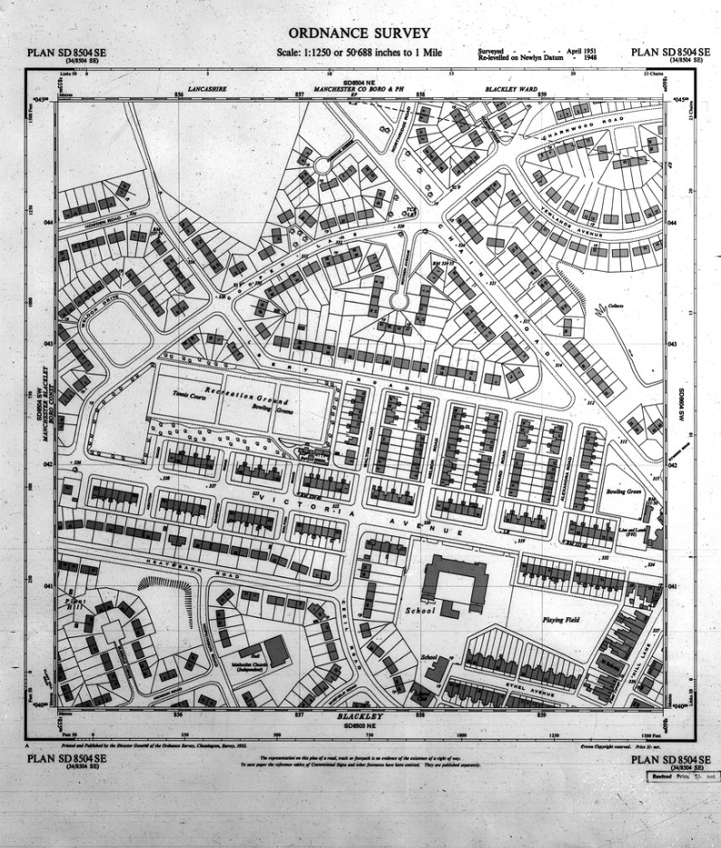
Before any shovel touches the ground, a thorough understanding of the terrain is necessary. One of the most useful resources for engineers, planners, and architects is the 1:1250 mapping scale from the Ordnance Survey. It depicts the world at a level where each wall, boundary, and outbuilding is remarkably accurate. It helps experts visualize how the built environment interacts with its natural context, and it is much more than just a simple picture. It is the cornerstone of confident decision-making.
Defining the 1:1250 Scale
An OS 1:1250 map indicates that one unit of the map corresponds to 1250 units of the ground. In reality, every one centimeter on paper corresponds to 12.5 meters. It is the ideal coverage to detail ratio at this scale. It is broad enough to make one realize a sense of context and environment and close enough to show the detailed design of streets and buildings. This accuracy allows surveyors to clearly understand the slightest variations in plot boundaries, layout and infrastructure alignment.
Unpacking the Level of Detail
Even the slightest details of the urban landscape become clear at this scale. Garden walls, footpaths, fences and garages are precisely mapped. There is also the distinct appearance of watercourses, trees lines and utility structures. Such careful rendering makes it possible to properly plot the property boundaries and determine the spatial connections between sites. The map is meaningful in each line, describing either a carriageway edge or a change of elevation.
The Role in Planning and Assessment
The 1:1250 mapping standard has offered an invaluable visual framework to the developers and consultants. Applications often need maps at this scale to confirm the accuracy of boundaries, and also to show the proximity of roads, rights of way, and existing utilities. The local authorities also use the same scale to evaluate the proposals with regard to existing land use, conservation areas, and environmental restrictions. By disclosing context in such detail, it facilitates the smooth execution of application processes and eliminates the risk of dispute or delay.
Establishing Confidence in Data Accuracy
Accuracy is fundamental to all land data interpretations. Aerial photography, ground surveys, and cutting-edge geospatial technologies that guarantee positional accuracy are all used in the Ordnance Survey’s mapping process. Professionals can overlay additional datasets without misalignment because buildings and features display within centimetres of their true coordinates. This reliability removes uncertainty and strengthens confidence in the data used for feasibility studies, evaluations, and values.
Supporting Infrastructure and Design Work
Civil engineers and architects frequently integrate 1:1250 mapping into design workflows. It provides a consistent base layer for modelling drainage networks, service lines, and access routes. Because the scale highlights both built form and open space, design teams can evaluate how proposed changes interact with the surrounding environment. For example, the width of a driveway, the location of street furniture, or the turning radius of delivery vehicles can all be studied with confidence using this scale.
Contextualising the Site Within Its Surroundings
In addition to technical analysis, there is also the context of the 1:1250 perspective. It places a site in its broader neighbourhood, showing how boundaries relate to streets, adjacent properties, and parcels of adjacent land. This sense of space can be used to make better environmental judgments and to understand the local topography better. It also allows planners to envision the possible impact of the surrounding developments and infrastructure on the proposed works.
Linking Mapping to Broader Decision Making
Maps of this scale are part of a larger range of Ordnance Survey products, which have been designed to fulfil a particular task. Although the 1:2500 and 1:10000 scales can be used to get a general geographical trend, the 1:1250 level is the point where accuracy meets practicality. It is detailed enough for technical use yet broad enough to retain perspective. Together with aerial imagery or 3D information, it forms the foundation of digital planning environments, improving transport modelling to the heritage preservation.
The Value in Clarity
The 1:1250 map is more than simply measurements on paper. It represents a link between concept and construction. It promotes more intelligent, secure, and sustainable development by exposing the intricate structure of land and property. Every form, wall, and contour adds to a common knowledge of place that is based on fact rather than conjecture.
A Foundation for Informed Progress
Contemporary planning relies on the tools which render complexity in a simple visual format. The 1:1250 Ordnance Survey map is still one of the most effective tools of accomplishing that objective. Its attention to detail, precision and context all come together to make professionals confident enough to act with insight. It is with this clarity that better sites are envisioned, stronger communities are created and the landscape is developed with intent as opposed to guesswork.